Quazi Hassan uses information from the past and present to predict future disasters and develop resiliency plans for mitigating the increasing risk of wildfires in Canada.
“Across the country and even across the world, disasters are displacing people,” Quazi Hassan states.
Today alone, nearly 22,000 residents of Yellowknife, NWT, face an evacuation order as wildfires approach the city. Other communities in the South Slave region, including Fort Smith, Salt River First Nation, Hay River, Kátł'odeeche First Nation, Enterprise, and Jean Marie River are all still under evacuation orders issued earlier in the week as well.
This year has seen unprecedented wildfires across Canada. More than 10 million hectares of land has burned, causing mass evacuations and the temporary displacement of more than 100,000 people. The fires have damaged hundreds of homes, and the smoke has lowered air quality across the country and the world. The increasing fire vulnerability this spring was predicted by Hassan’s forecasting.
In Hassan’s opinion, “disasters shape the world.” His dedication and expertise led him to pursue a PhD and a professional engineering licence in Canada, while his lifelong fascination with disasters eventually led him to Alberta and its risks for floods, landslides, and wildfires. As a geomatics engineer, he collects data from past disasters, examines current conditions, and then models the possibility of disasters in the future. This work can provide guidance on everything from public policy to site suitability and mitigation measures.
As the wildfires and extreme weather Canada has experienced this summer have demonstrated, our world is changing rapidly in the face of climate change. Though Hassan’s work won’t stop the fires already burning, it is vital in preventing and fighting future disasters.
The past in our present
“I have had a fascination for a long time about disasters,” Hassan admits. “Disasters can shape our life, and that has been the case throughout the history of human civilization. That is the reason I focus on disasters. I like to look at, how do we adapt? How do we place measures for mitigation?”
In 2021, a heat wave in British Columbia killed over 500 people. In response, BC has been working to change its building codes and looking at their healthcare system to prevent this from happening in the future. Hassan points to these events as an example of how disasters in the past impact the present—“And how it is connected to the future, as well,” he adds.
Hassan did not always work with wildfires at the University of Calgary. For his PhD in remote sensing and environmental modeling at the University of New Brunswick, his focus was on site suitability.
“Let’s say you have a plot, your front or backyard,” Hassan says. “You know very well, through your experience, what you can grow there. Now, let’s say I ask you to look across all of Atlantic Canada... I’m at location A, what type of plants can I grow there?”
To solve a problem like this, Hassan would use remote sensing, which involves collecting data on physical characteristics in a given area, and then develop an engineering solution that can apply the data to any location in Atlantic Canada and provide a list of potential plants. This can include satellite data, ground level data, data on wind conditions or humidity; it all depends on what information you’re trying to uncover.
Site suitability looks at the suitability of a site for a specific project. A site might be studied to determine risk of flooding, river migration, land use, amount of land cover, and of course, risk of wildfire.
Predicting wildfires and improving community resilience
Hassan uses public information from any source he can access, whether it’s local, provincial, or federal. “I focus primarily on the data collected from satellites... in terms of satellites, we can only go back 30 to 40 years,” Hassan explains. “Another is ground data... in Canada, we have around 100 years of recorded data.” After the data is collected and the quality is assessed, then he can try to determine what happened and what was the cause.
To determine the probability of a wildfire, Hassan looks at several different variables. Are the temperatures higher than normal? Was there less snowfall in the winter, leading to less precipitation in the spring? What is the relative humidity like? The most common cause of major wildfires is lightning strikes, and that information also has to be taken into account.
“Once we combine all these factors... then we will be in a position to say these are the locations that may be more vulnerable,” Hassan explains. “We need to study backwards, to understand what happened, and then we can watch the future.”
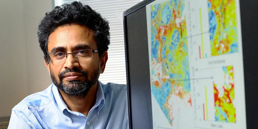
The 2011 Slave Lake and 2016 Fort McMurray wildfires are two well-known wildfire events in Alberta. Hassan has studied both, focusing on community resiliency. “I looked into how it propagated through the community and what could be the major changes... so that [damages] could be reduced.”
Several mitigation measures were proposed. A ring road around the entire urban center could serve as both a fire barrier and an easily accessible evacuation route and means to deploy emergency services. For schools and large retail developments near forested areas, paved surfaces and parking lots could serve as barriers between the buildings and the forested lands. Hassan also looked into less flammable building materials that could be used for rebuilding and more fire-resistant plants for future green space.
Community resiliency can also involve improving fire safety knowledge. In places where single, free-standing homes have 4 feet of clearance between their home and the property line, there’s a total of 8 feet of space between houses. This free space area can act as a natural barrier to prevent fire from jumping. But, most homeowners are not aware of this and the spaces beside houses are filled with storage bins, woodpiles, furniture, and other flammable items. This negates the effectiveness of the barrier and risks increasing the likelihood of fire spreading from house to house.
Funding for forecasting
A key tool in the fire prevention toolbelt is forecasting. But in order to have regular, frequent forecasts, a team needs to be operating the system. Hassan developed a fire forecasting system around 2010—years before both the Slave Lake and Fort McMurray fires. As a researcher, he can develop systems like this for a wide variety of places. What he cannot do is run them continuously. That sustained effort requires an operational team and the resources to fund the work.
Some large oil and gas companies do have both the people and money required to sustain this type of operation. In northern Alberta, one company uses a system Hassan developed to forecast a 30 km2 area around their operations for up to eight days ahead. This forecast allows them to plan ahead for possible fires and provides them with the extra time they need to shut down their systems safely and evacuate their personnel. Unfortunately, achieving this type of detailed forecasting on a larger scale is not currently feasible.
A growing threat
One key problem is the speed at which the global temperature is changing. “The warming is prominent... Climate change will put enormous pressure [on us],” Hassan says. Over thousands of years, a one or two degree change in temperature is negligible. “But if one degree happens within our lifetime, you will see lots of impact. That's not only fire, it also destroys houses, it destroys our communication network, transportation, telecommunication, all kinds of things.”
It’s an uncomfortable reality, to be faced with something that we can quantifiably say is getting worse each year. But Hassan does not think we are doomed. He has faith that the work he is doing, and the work of others in his field, will become part of the solution.
“It's basically a circular issue,” Hassan explains. “All the components are interconnected and dependable on each other. So consequently, once we are working, especially on environmental issues, adaptation, monitoring, mitigation... we can slow it down and then we can recover.”
Disasters are a matter of survival. Survival comes first, and everything else second. It is in this space after we survive a disaster that Hassan expects to see innovation and opportunity. The biggest challenge for engineers, Hassan says, is having enough engineers in leadership positions to implement the solutions they devise.
“If you are not a leader, then your innovation will never go to a particular point. You cannot reach the summit because you don't have the room to be innovative,” he says.
Hassan is currently using his position to advocate for ways that engineers can work on mitigating damage caused by climate change, through a course he created called Climate Change Adaptation for Engineers.
Despite its popularity, Hassan was only able to get the course created once he became a director himself. “We need to develop leadership skills,” he says. “It could be in the community, it could be politics, it could be this or that. But we need to go there, right? Otherwise, our great work will completely erode over time.”
Hassan believes that engineers are uniquely suited to proposing solutions to complex real-world problems. “Nobody is born as an inbuilt engineer or physician or politician... They need to practice, to refine themselves.” The process of experimentation, failure, and innovation that is inherent to the engineering profession is what Hassan thinks will need to be more prominent in the future.
In the face of the looming impact of climate change, Hassan reminds us that everything is circular. “If the environment sustains, we sustain; if we sustain, then we will take care of the environment. So by that way, you know we will put our hand to each other and then we will work for as long as we need to.”
Engineers build more than just bridges. Building Tomorrows is a series that highlights the important contributions of engineers and the many ways they help to make our world a better place.